
🌐 TH-U30 Industrial Inspection & Mapping UAV — One-Pager(English Version)
(Professional Sales Copy — Ready for Brochure / PPT / Website)
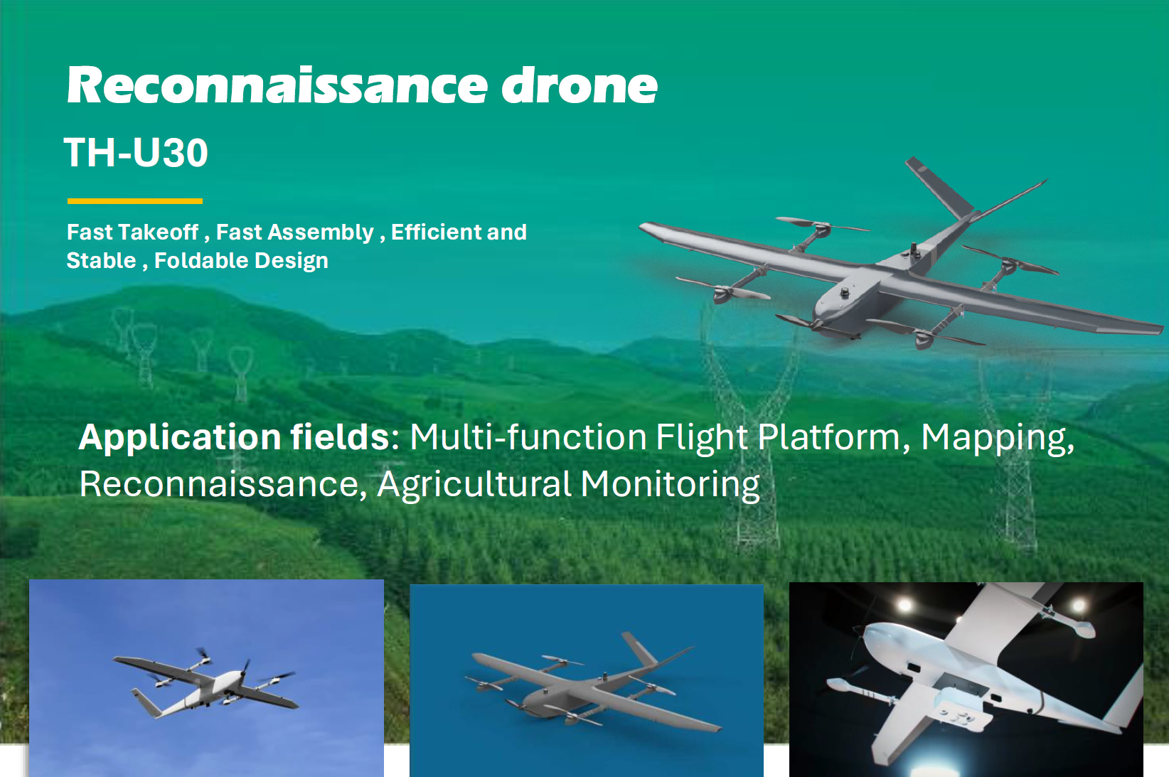
TH-U30 — Industrial Long-Endurance Fixed-Wing UAV
Reliable · Efficient · Versatile
Designed for energy, utilities, mining, and infrastructure inspection.
CORE HIGHLIGHTS
- 120–90 min endurance with 3–5 kg professional payload
- Large inspection radius (30–80 km) suitable for most industrial tasks
- High-efficiency electric propulsion — simple maintenance & low noise
- Quick deployment: 2-person team, 20 minutes assembly
- Supports EO/IR gimbals, multispectral cameras, Lidar
APPLICATION SCENARIOS
1. Solar Power Plant Inspection
Automated grid-based scanning using thermal + RGB sensors to detect:
- Hot spots
- Damaged modules
- String failures
Customer benefit: Up to 80% efficiency improvement over manual inspection.
2. Wind Farm Inspection
Used for:
- Turbine base & road surveillance
- Blade hot-spot scanning
- Perimeter patrol
Customer benefit: Enables frequent low-cost inspection even in remote highland terrain.
3. Mining & Quarry Mapping
- 2D/3D mapping (DEM/DOM)
- Stockpile volume measurement
- Safety perimeter monitoring
Customer benefit: High accuracy mapping with reduced manpower.
4. Power Line & Substation Patrol
- Medium-range power lines
- Transformers, switches, and insulators visual checks
Customer benefit: Rapid detection of overheating and component degradation.
5. Industrial Park & Factory Perimeter Security
- Day/night surveillance with EO/IR
- Identifying unauthorized entry, fire risks
Customer benefit: Replace multiple ground security posts with a single UAV system.
KEY SPECIFICATIONS
| Item | Specification |
|---|---|
| Maximum Take-off Weight | ~30 kg |
| Endurance | 120 min (3 kg payload), 90 min (5 kg payload) |
| Cruise Speed | 70–110 km/h |
| Max Speed | 140 km/h |
| Operating Radius | 30–80 km |
| Payload Capacity | 3–5 kg |
| Compatible Payloads | EO/IR, multispectral, Lidar |
| Wingspan | ~3.0 m |
| Takeoff / Landing | Short takeoff / belly landing |
| Power System | Full electric propulsion |
| Assembly Time | < 20 minutes |
Full technical datasheet available upon request.
TYPICAL INDUSTRIAL PACKAGE CONFIGURATION
TH-U30 Industrial Inspection Set
- 1× TH-U30 UAV
- 1× EO/IR dual-light gimbal or Multispectral/Lidar payload
- 1× Flight control & ground station software
- 1× Automated mission planning toolkit
- Optional: AI analysis package (thermal anomaly detection, mapping processing)
- 2–3 day on-site training
Download: TH-U30_Industrial_Inspection__Mapping_UAV.pdf
🇨🇳 TH-U30 工业巡检与测绘无人机 — 一页纸(中文正式版)
TH-U30 — 工业级长航时固定翼无人机
高效 · 稳定 · 多用途
专为能源、电力、新能源、矿山、基础设施巡检场景设计。
核心亮点
- 120–90 分钟航时(3–5 kg 专业载荷)
- 30–80 km 巡检半径,满足绝大部分工业任务
- 纯电推进,维护简单,噪声低、可靠性高
- 两人快速部署,20 分钟完成组装与预飞检查
- 支持挂载 EO/IR 双光吊舱、多光谱相机、激光雷达 Lidar
典型应用场景
1. 光伏电站巡检(热成像 + 可见光)
可快速定位:
- 热斑组件
- 损坏串列
- 汇流箱异常
**客户收益:**巡检效率较人工提升 80% 以上。
2. 风电场巡检
用于:
- 风机基础、道路情况监测
- 扇叶表面热斑预警
- 周边场区巡逻
**客户收益:**适合高原/山地复杂环境,显著降低巡检成本。
3. 矿山测绘与安全监测
适用:
- 高精度 DEM/DOM
- 堆体体积测量
- 采场边坡安全巡查
**客户收益:**高效率 + 高精度,替代传统人工测量方式。
4. 中压输电线路与变电站巡检
- 导线、金具、绝缘子外观检查
- 变电站局部热点排查
**客户收益:**快速扫描 + 热成像精准定位问题点。
5. 工业园区 / 港口 / 工厂周界安防
- 昼夜双光巡逻
- 人员/车辆异常行为检测
**客户收益:**以一台飞机覆盖完整园区,大幅减少人力消耗。
关键参数
| 项目 | 参数 |
|---|---|
| 最大起飞重量 | 约 30 kg |
| 航时 | 120 分钟(3 kg 载荷) / 90 分钟(5 kg 载荷) |
| 巡航速度 | 70–110 km/h |
| 最高速度 | 140 km/h |
| 任务半径 | 30–80 km |
| 有效载荷 | 3–5 kg |
| 可挂载载荷 | 双光吊舱、多光谱、激光雷达等 |
| 翼展 | 约 3.0 m |
| 起降方式 | 短距起飞 / 腹降落地 |
| 动力系统 | 纯电推进 |
| 部署时间 | < 20 分钟 |
可根据客户需求提供完整技术规格书。
典型行业套装(示例)
TH-U30 工业巡检套装
- TH-U30 工业级固定翼无人机 ×1
- 专业 EO/IR 双光吊舱或多光谱/Lidar ×1
- 地面站 + 任务规划软件(含光伏/风电巡检模板)
- 数据分析工具包(自动热斑识别、测绘处理)
- 2–3 天现场培训与试运行